

QuantaLab IAS-CSIC
The Laboratory for Research Methods in Quantitative Remote Sensing (QuantaLab) is led by Dr. Zarco-Tejada, and belongs to the Institute for Sustainable Agriculture (IAS), National Research Council (CSIC), Spain.
Remote Sensing in Agriculture and Forest Ecosystems
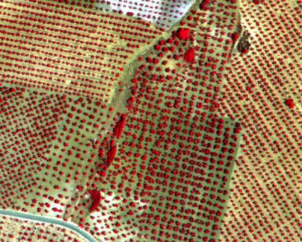
QuantaLab's work focuses on quantitative methods for remote sensing in agriculture and forest ecosystems, primarily in vegetation water and nutrient stress detection, physiological condition and precision agriculture.
Hyperspectral and Thermal Imagery
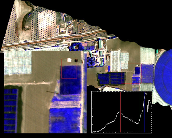
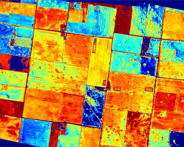
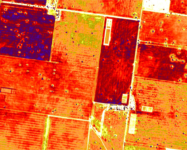
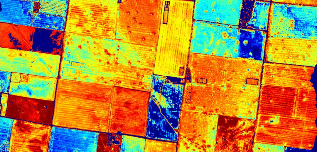
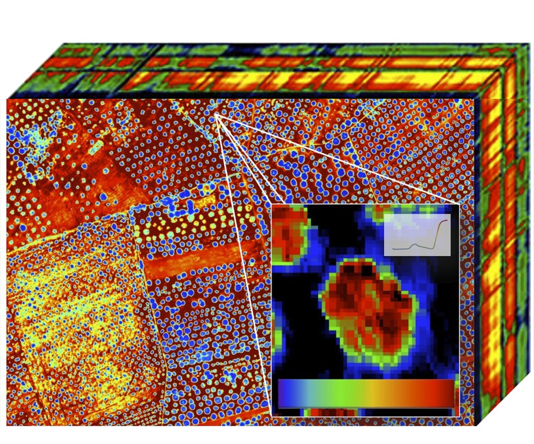
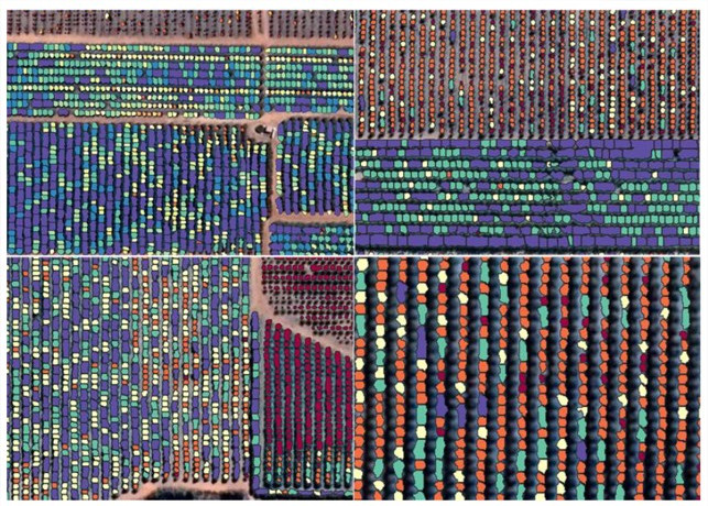
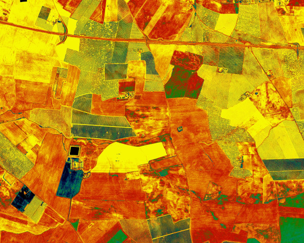
QuantaLab's researchers have experience with airborne hyperspectral and thermal sensors to estimate leaf biochemical and canopy biophysical parameters and the effects of chlorophyll fluorescence on leaf and canopy reflectance. The hyperspectral and thermal imagers operated by QuantaLab are used to develop methods for successfully estimating vegetation biochemical traits, leaf nitrogen, water content and structural traits in uniform and heterogeneous canopies.
Perspective
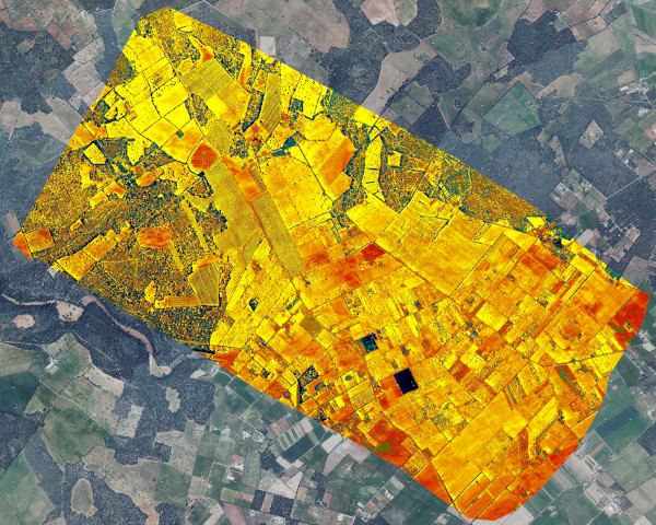
QuantaLab's innovative research methods are based on piloted and unpiloted platforms (UAS / UAVs) carrying passive and active imaging sensors for precision agriculture, environmental impact assessment, stress detection, and irrigation management. The group participates in EU, ESA, NASA and Spanish-funded research projects primarily focusing on hyperspectral remote sensing technologies and algorithm development. QuantaLab also leads research projects with private companies worldwide focused on applied research and technology transfer.
People
Dr Pablo J. Zarco-Tejada
Quantalab Team Leader
Dr Zarco-Tejada is QuantaLab's Team Leader. His primary focus is remote sensing technology and methods, precision agriculture and vegetation stress detection using hyperspectral and thermal imagery acquired by aircraft and unpiloted aerial systems (UAS/UAVs), in particular, assessing the physiological condition of vegetation through physically-driven algorithms. These include the early detection of plant diseases and water and nutrient stress using advanced airborne imaging spectroscopy, thermal imaging and solar-induced fluorescence quantification through radiative transfer modelling.
Dr Alberto Hornero
Postdoctoral Researcher
Alberto Hornero holds a BS in Computer Systems Engineering, an MS in Computer Science from the University of Córdoba (Spain), and a PhD in Physical Geography from Swansea University (UK). One of his primary areas of research is focused on the latest advancements in Remote Sensing technology and methods. His current research focuses on quantitatively estimating vegetation traits and dynamics using high-resolution hyperspectral and thermal data, medium-resolution satellite imagery, artificial intelligence and radiative transfer modelling.
Dr Na Wang
Postdoctoral Researcher
Na Wang is a postdoctoral researcher working across Quantalab and IrriSens laboratories at IAS-CSIC. She holds a BS in Geo-information Science, an MS in Remote Sensing of Agriculture, and a PhD in Remote Sensing of Fluorescence in Precision Agriculture. Her research interests revolve around sun-induced chlorophyll fluorescence (SIF), biotic/abiotic stress detection in crops/ fruit trees at different spatial scales (e.g., airborne, UAV, and proximal canopy), and multi-sensor synergy approaches. Her current research is focused on assessing the water stress status in almond and pistachio orchards using advanced multi-sensor approaches, including SIF from both airborne sub-nanometre fluorescence imagery and narrow-band imagery as well as thermal data.
David Notario Rosingana
Remote Sensing Specialist
David Notario ensures efficient data acquisition using remotely piloted aircraft systems (RPAS) and aircrafts. He coordinates flights, ensuring compliance with regulations and troubleshooting any issues. Proficient in thermal and hyperspectral image processing, David analyses data using advanced software and algorithms, extracting valuable insights. His detail-oriented and analytical approach contributes to research projects and interdisciplinary collaborations, making him an invaluable asset to the lab.
Alberto Vera Toscano
Aerial Operations Specialist
Alberto Vera oversees the operation and accurate calibration of RPAS, spearheading the implementation of adaptations and new developments to ensure safe flight operations. His responsibilities extend to manned flight management, including sensor installation and overseeing all logistical aspects. Alberto ensures that each mission meets the highest standards of safety and efficiency. His experience in coordinating complex projects and his proactive approach to problem solving make him a crucial contributor to the team's success.

Julia Bujalance Rodríguez
Remote Sensing Data Analyst
Julia focuses on developing automated solutions for processing hyperspectral images acquired by piloted aircraft and drones. Her work includes feature point extraction, image rectification, and mosaicking, using deep neural network-based methods to accurately register multiband images against a georeferenced image of the study area and generate high-precision mosaics with minimal human intervention.
Alumni
- Oscar Pérez Priego
- Guadalupe Sepulcre Cantó
- José A.J. Berni
- Lola Suárez Barranco
- Mª Luz Guillén Climent
- Rocío Hernández Clemente
- Jesús Rodríguez González
- Rocío Calderón Madrid
- Carlos Camino González
Visiting Scientists
- John R. Miller York University (Canada)
- Dr. Susan L. Ustin UC Davis (USA)
- Alex Held CSIRO (Australia)
- Ismael Moya CNRS (France)
- Peter R.J. North University of Swansea (UK)
- Ana Prieto University of Swansea (UK)
- Raúl López-Lozano CITA (Spain)
- Inian Moorthy York University (Canada)
- Caroline Nichol University of Edimburgh (UK)
- Lexie McClymont Horticulture Industry Networks (Australia)
- Hamza Mghari CIHEAM Bari (Italy)
Graduate Research
QuantaLab – IAS – CSIC focuses on hyperspectral and thermal imagery to assess water stress and to estimate leaf biochemical and biophysical variables thought leaf and canopy modelling. The effects of chlorophyll fluorescence on leaf apparent reflectance are investigated through radiative transfer modelling and airborne hyperspectral imagery. QuantaLab’s main research interests are related to forest and crop stress condition, ecophysiological applications of remote sensing, and precision agriculture. Graduate research work is funded by Spanish and European research projects.
2025. PhD Thesis. Peiye Li, Assessment of needle nitrogen and phosphorus in Pinus radiata using functional traits estimated by physically based models and solar-induced fluorescence from airborne hyperspectral imagery. Principal supervisor. Co-supervision with Dr. Tomas Poblete, Faculty of Engineering and Information Technology (FEIT), University of Melbourne, Australia.
2025. PhD Thesis. Luis Guadarrama. Increasing the genetic diversity of barley: widening the primary gene pool for drought tolerance genetic improvement. Co-supervision with Mohammad Pourkheirandish. Faculty of Science, University of Melbourne, Australia.
2024. PhD Thesis. Jamie Gough, Applications of Precision Agriculture (PA) tools to manage climate variability in pastures in Southeast Australia. FVAS. Co-supervision with Dr. Brendan Cullen and Prof. Richard Eckart. Faculty of Science, University of Melbourne, Australia.
2023. PhD Thesis. Anne Wang, Assessing the contribution of solar-induced fluorescence (SIF) to the estimation of nutrient status in almond orchards. Principal supervisor. Co-supervision with A/Prof. Dongryeol Ryu and Dr. Lola Suarez. Faculty of Engineering and Information Technology (FEIT), University of Melbourne, Australia.
2023. PhD Thesis. Anirudh Belwalkar. Evaluating the impact of the spectral configuration of airborne hyperspectral imaging sensors on the accurate estimation of solar-induced chlorophyll fluorescence (SIF). Principal supervisor. Co-supervision with Dr Tomas Poblete. Faculty of Engineering and Information Technology (FEIT), University of Melbourne, Australia.
2023. PhD Thesis. Andrew Longmire. Wheat grain protein content assessment via plant traits retrieved from airborne and satellite remote sensing images. Co-supervision with Prof. Deli Chen. FVAS. University of Melbourne, Australia.
2022. MSc Thesis. James Thompson, The Implications of Solar-Induced Fluorescence Pixel Heterogeneity on the Quantification of Large Scale Photosynthesis. Master in Mathematics and Atmospheric Science. Co-supervision with Prof. Peter Rayner. Faculty of Science, University of Melbourne, Australia.
2021. PhD Thesis. Alberto Hornero, Quantitative estimation of vegetation traits and temporal dynamics using 3-D radiative transfer models, high-resolution hyperspectral images and satellite imagery. Swansea University. Supervisors: Peter R.J. North & Pablo J. Zarco-Tejada.
2019. TFG. Wey Yao Wong, Distinguishing abiotic and biotic water stress symptoms in physiology-related hyperspectral indicators with Verticillium wilt in tomatoes. Bachelor of Science. Primary Supervisor: Pablo J. Zarco-Tejada, Co-supervisor: Dr. Lola Suarez.
2019. PhD Thesis. Carlos Camino, Estimation of nitrogen content from hyperspectral VNIR-SWIR and thermal imagery under water- and nutrient-stress conditions. Supervisors: Dr. P.J. Zarco-Tejada & V. Gonzalez-Dugo.
2015. PhD Thesis. Rocío Calderón Madrid, Detection of Verticillium wilt in olive using high-resolution hyperspectral and thermal remote sensing imagery. Supervisors: Dr. P.J. Zarco-Tejada & J.A. Navas (IAS-CSIC).
2014. PhD Thesis. Joaquim Bellvert, El uso de la teledetección de alta resolución como herramienta para realizar un manejo eficiente del riego en viñedos. Supervisors: Dr. Elías Fereres Castiel (UCO), P.J. Zarco-Tejada (IAS-CSIC).
2012. PhD Thesis. Rocío Hernandez-Clemente, Detección de estrés en coniferas mediante teledetección hiperespectral y térmica de alta resolución y modelos de transferencia radiativa. Universidad de Córdoba. Supervisors: Rafael Navarro (UCO) & P.J. Zarco-Tejada (IAS-CSIC).
2012. PhD Thesis. Mari Luz Guillén Climent, Estimación de radiación interceptada en cultivos discontinuos mediante teledetección y modelos de transferencia radiativa. Universidad de Córdoba. Supervisors: P.J. Zarco-Tejada (IAS-CSIC), Dr. F.J. Villalobos.
2009. PhD Thesis. Lola Suárez, Estudio de Estrés Hídrico en vegetación mediante el uso de índices y modelos de transferencia radiativa. Universidad de Córdoba. Supervisors: P.J. Zarco-Tejada (IAS-CSIC), Dr. E. Fereres Castiel (UCO).
2009. PhD Thesis. José A. Jiménez Berni, Determinación del estado hídrico de la vegetación mediante teledetección basada en vehículos aéreos no tripulados. Universidad de Córdoba. Supervisors: P.J. Zarco-Tejada (IAS-CSIC), Dr. E. Fereres Castiel (UCO).
2008. PhD Thesis. Guadalupe Sepulcre Cantó, Detección de estrés hídrico en árboles frutales mediante teledetección térmica de alta resolución espacial AHS e imágenes ASTER, Universidad de Valencia. Supervisors: P.J. Zarco-Tejada (IAS-CSIC), J.A. Sobrino (Univ. Valencia).
2007. PhD Thesis. Alberto Berjón Arroyo, Estimación de Variables Biofísicas en Cubiertas Cerradas mediante Métodos de Teledetección , Universidad de Valladolid. Supervisors: P.J. Zarco-Tejada (IAS-CSIC), Dra. Victoria Cachorro.
2007. MSc Thesis, João da Gama Minas, Detección de Variables Biofísicas en Olivar mediante métodos de Teledetección Hiperespectral por Satélite y Sensores Aerotransportados para su Integración en Agricultura de Precisión , Master en Olivicultura, Universidad de Córdoba. Supervisor: P.J. Zarco-Tejada (IAS-CSIC).
2007. MSc Thesis, Anne van Gijsel, Retrieving open canopy vegetation parameters using vegetation indices and model inversion. Detection of iron chlorosis in olive orchards using CASI data and radiative transfer modelling . Supervisors: P.J. Zarco-Tejada (IAS-CSIC, Spain) and J.G.P.W. Clevers (WU, The Netherlands). Wageningen University & Centre for Geo-information, The Netherlands.
2004. TPFC, Oscar Pérez Priego, Detección de Estrés Hídrico en Olivar mediante Fluorescencia Clorofílica, Métodos de Espectroscopía y Teledetección Térmica , Universidad de Córdoba. Supervisors: P.J. Zarco-Tejada (IAS-CSIC), Dr. Elías Fereres Castiel (UCO).
2004. Research Stage. PhD Candidate Ana Prieto. University of Swansea, UK. Supervisor: P.J. Zarco-Tejada (IAS-CSIC).
2003. TPFC, Berta Gil, Aplicación de Técnicas de Teledetección Hiperespectral en Viñedo fertilizado con extracto de Algas , Universidad de Valladolid. Supervisors: P.J. Zarco-Tejada (IAS-CSIC), Dr. Jesús Martín Gil.
Dr. Zarco-Tejada, PhD Thesis, York University, Canada, Year 2000: “Hyperspectral Remote Sensing of Closed Forest Canopies: Estimation of Chlorophyll Fluorescence and Pigment Content”, PhD Thesis, Earth and Space Science Program, York University, Toronto, Canada, 233 pages.
Research Opportunities
Prospective MSc and PhD candidates are encouraged to contact Dr Zarco-Tejada regarding research opportunities on hyperspectral remote sensing, chlorophyll fluorescence detection using passive instruments, stress detection with hyper-multispectral and thermal sensors, and leaf and canopy modelling using radiative transfer (physical) approaches.
Students from Agriculture, Forestry and Engineering backgrounds with interests in image processing, instrumentation, drones, airborne remote sensing, and physical and statistical methods are encouraged.
Research Projects
Last updated in February 2026.
- Caracterización de las necesidades hídricas de una plantación de pistacho en desarrollo en el Valle del Guadalquivir (DGP_PIDI_2024_02625). Ayudas a proyectos de investigación aplicada y desarrollo experimental por los agentes del sistema andaluz del conocimiento: 2026-2029. IP: M.V. González-Dugo. Junta de Andalucía.
- Tracking resilience and early assessment of disturbances: an automated early-warning system for forest vulnerability using functional traits and thermal remote sensing. Referencia: 101084481. European Commission, Ref.:291014. 04/06/2025-03/06/2027. IP: A. Hornero.
- Understanding the economic impact of Macrophomina (Charcoal rot), TA ID: 109239, Sponsor: GRAINS RESEARCH & DEVELOPMENT CORP, Type: Research Grant Award, P.J. Zarco-Tejada (co-Investigador), Start Date: 4-Jan-24, End Date: 31-Aug-26. Universidad de Melbourne, Australia.
- Extracting tree structural information from LiDAR data to inform above-ground carbon estimations, TA ID: 306616, Sponsor: Contract Research, Type: Research Contracts Award, P.J. Zarco-Tejada (IP), Start Date: 8-Jul-24, End Date: 15-May-25. Universidad de Melbourne, Australia.
- The soil biodiversity and functionality of mediterranean olive groves: a holistic analysis of the influence of land management on olive oil quality and safety', EU project Soil-O-Live, ID: 256029020. 01/01/2023 - 31/12/2027. HORIZON-MISS-2021-SOIL-02, European Commission. IP: Antonio J. Manzaneda, UJA. Pilar Hernández Task Leader at IAS-CSIC.
- Evaluación agronómica de los nuevos sistemas productivos del almendro, Referencia proyecto: PID2022-138451OB-I00, Ministerio de Ciencia e Innovación, IP: M.V. González Dugo, 01/09/2023 - 31/08/2027.
- Beyond Xylella, integrated management strategies for mitigating Xylella fastidiosa impact in Europe (BeXyl), Referencia proyecto: 101060593, Entidad que financia: Comisión Europea (EuropeAid), P.J. Zarco-Tejada (WP2 leader), Fecha inicio: 01/09/2022, Fecha fin: 31/12/2026. IP: B. Landa.
- Evaluación de indicadores funcionales de carácter espectral en el contexto de la mejora de la adaptación del trigo a las condiciones agroclimáticas andaluzas (Referencia: P18-RT-992). P. Hernández-Molina (IP), Junta de Andalucía, España. Duración: 01/01/2020 - 31/12/2022.
- Mapping of non-woody vegetation on the Murray River floodplain using multispectral sensors onboard unmanned aerial platforms, TA ID: 305448, Sponsor: Contract Research, Type: Research Contracts Award, IP: P.J. Zarco-Tejada, Start Date: 24-Apr-23, End Date: 31-Aug-23, Universidad de Melbourne, Australia.
- Remote sensing of biotic stress with hyperspectral-fluorescence imaging, TA ID: 107193, Sponsor: AUSTRALIAN RESEARCH COUNCIL (ARC), Type: Research Grant Award, IP: P.J. Zarco-Tejada. Start Date: 1-Aug-22, End Date: 31-Jan-27, Universidad de Melbourne, Australia.
- Steps to advance lower-cost, accurate Carbon measurement for Australian soils, TA ID: 107453, Sponsor: DEPARTMENT OF INDUSTRY, SCIENCE, ENERGY & RESOURCES (NMI), Type: Research Grant Award, IP: P.J. Zarco-Tejada, Start Date: 4-Apr-22, End Date: 31-Aug-22. Universidad de Melbourne, Australia.
- Seeing the forest for the trees: transforming phenotyping for future forests, TA ID: 303793, Sponsor: SCION New Zelanad, Type: Research Contracts Award, IP: P.J. Zarco-Tejada, Start Date: 1-Nov-21, End Date: 30-Dec-24, Universidad de Melbourne, Australia.
- Boundary Bend-Precision agriculture and hyperspectral remote sensing technologies for olive orchard management, TA ID: 303518, Sponsor: Contract Research, Type: Research Contracts Award, IP: P.J. Zarco-Tejada, Start Date: 15-Oct-21, End Date: 15-Nov-24, Universidad de Melbourne, Australia.
- Harnessing the power of airborne high spatial resolution hyperspectral imagery for the softwood plantation industry, TA ID: 106781, Sponsor: National Institute for Forest Products Innovation (NIFPI), Forest & Wood Products Australia (FWPA) and HPV plantations. Type: Research Grant Award, IP: P.J. Zarco-Tejada, Start Date: 25-Aug-21, End Date: 30-Sep-24, Universidad de Melbourne, Australia.
- Pilot study to assess airborne hyperspectral images for nutrient assessment of pine plantations, TA ID: 302387, Sponsor: Contract Research, Type: Research Contracts Award, IP: P.J. Zarco-Tejada, Start Date: 1-Jan-21, End Date: 31-Jan-23. Universidad de Melbourne, Australia.
- Detection of Verticillium wilt in olive using remote sensing imagery, TA ID: 302264, Sponsor: Contract Research, Type: Research Contracts Award, IP: P.J. Zarco-Tejada, Start Date: 23-Nov-20, End Date: 31-Jul-21. Universidad de Melbourne, Australia.
- Enabling analytics for grain crop monitoring applications - Crop classification and mapping of phenological characteristics, TA ID: 105757, Sponsor: Grains Research & Development Corp., Research Grant, IP: P.J. Zarco-Tejada (University of Melbourne), Start Date: 17-Jun-20, End Date: 30-Sep-24, Universidad de Melbourne, Australia.
- Artificial intelligence methods for early disease detection using hyperspectral and thermal imagery, Department of Agriculture, Water, and the Environment (DAWE), IP: P.J. Zarco-Tejada, 2020- 2022. Universidad de Melbourne, Australia.
- Copernicus Applications and services for Low impact agriculture in Australia (COALA), TA ID: 105282, Sponsor: European Commission, Type: Research Grant, D. Ryu (IP), P.J. Zarco-Tejada (co-I), Start Date: 1-Jan-20, End Date: 31-Aug-23. Universidad de Melbourne, Australia.
- Hyperspectral Remote Sensing of Wheat Crops for rapid assessment of effective nutrient status and improved crop growth model performance., TA ID: 104515, Sponsor: Grains Research & Development Corp. (GRDC), Type: Research Grant, P.J. Zarco-Tejada (co-Investigator), Start Date: 1-Mar-19, End Date: 30-Apr-23. Universidad de Melbourne, Australia.
- Moira Grass Remote Mapping, TA ID: 39976, Sponsor: Contract Research, Type: Research Project, IP: P.J. Zarco-Tejada, Start Date: 29-Jan-19, End Date: 31-Aug-19. Universidad de Melbourne, Australia.
- Xylella Fastidiosa Active Containment Through a multidisciplinary-Oriented Research Strategy (XF-ACTORS, European Union, Horizon 2020 Research and Innovation Programme; Grant Agreement No. 727987 (DOI: 10.3030/727987); 1 Nov 2016 – 30 Apr 2021. Consortium partner: European Commission, Joint Research Centre (JRC). Coordinator: Consiglio Nazionale delle Ricerche (CNR), Italy.
- Pest Organisms Threatening Europe (PONTE), European Commission, Ref.: 635646. 01/11/2015 - 31/10/2019. IP: B. Landa.
- 2013-15. Monitorización Espacial de la Fluorescencia Clorofílica como indicador del estado fotosintético a partir de sensores hiperespectrales a bordo de vehículos aéreos no tripulados, AGL2012-40053-C03-01, Ministerio de Economia y Competitividad. IP: Pablo J. Zarco-Tejada.
- 2012-14. FieldCopter. Unión Europea. SIPT1100X001786XV0. FP7-GALILEO-2011-GSA-1-b Collaborative Project – CP. Galileo.2011.1.7-1. I.P.: P.J. Zarco Tejada.
- 2011-13. Agric-LaserUAV. Unión Europea. FP7-PEOPLE-2009-IIF Marie Curie Actions. IFF:International Incoming Fellowships (IIF). Galileo.2011.1.7-1. I.P.: P.J. Zarco Tejada.
- 2011-14. Proyecto INNPACTO. Ministerio de Ciencia e Innovación (MICINN). SIPT1100X001786XV0. I.P.: P.J. Zarco Tejada.
- 2009-12. Teledetección hiperespectral y térmica para detección de estrés y monitorización de parámetros fisiológicos en vid y olivar. AGL2009-13105-C03. I.P.: P.J. Zarco Tejada.
- 2009-10. Evaluation of total leaf tissue water potential and total pigments by optical properties and color space index for major tropical trees, National Authority for Remote Sensing and Space Sciences (NARSS), A/020692/08, I.P. Zarco Tejada, P.J.
- 2006-10. Programa Integral de Ahorro y Mejora Productiva del Agua de Riego en la Horticultura Española, Consolider CSD2006-00067. Ministerio de Educación y Ciencia (MEC). P.I.. E. Fereres.
- 2005-10. A Surveillance System for Assessing and Monitoring of Desertification (DeSurvey). Sixth Framework Programme, Global Change and Ecosystems. Module Leader: E. Fereres.
- 2007-09. Cuantificación del balance de carbono en ecosistemas de matorral y olivar a escalas globales mediante teledetección hiperespectral y térmica. SUM2006-00018-C02-02. Instituto Nacional de Investigación y Tecnología Agraria y Alimentaria (INIA). Coordinadora: Ana Rey. P.I. subproyecto: Pablo J. Zarco Tejada.
- 2007-09. Prototipo de medida de Fluorescencia Clorofílica de la vegetación mediante absorción diferencial en la banda O2-A (proFLEX). Ministerio de Educación y Ciencia (MEC). P.I.: Pablo J. Zarco Tejada.
- 2007-09. Estudio sobre la utilización de satélites térmicos de resolución media para identificación de parcelas de olivar en regadío en la Cuenca Hidrográfica del Guadalquivir. DAP-CHG. P.I.: Pablo J. Zarco Tejada.
- 2006-09. Spectral Bio-Indicators of Ecosystem Photosynthetic Efficiency, NNH05ZDA001N, A.7 [RS Science for Carbon and Climate], NASA-ROSES AO, P.I.: E. Middleton.
- 2008. Creación de una Red Nacional de Teledetección Ambiental, Ministerio de Educación y Ciencia, CGL2007-28828-E/BOS, I.P. Chuvieco Salinero, E.
- 2008. Colaboración científica con Canadá para aplicación en zonas agrícolas de España de un sensor láser terrestre para estimación de parámetros estructurales de cultivo, MEC – Acciones Complementarias Internacionales, PCI 2006-A7-0685. P.I.: Zarco-Tejada, P.J.
- 2007-08. Impact assessment of solar induced vegetation fluorescence observations from space for improving dynamic vegetation models (AO-5229, ECOFLUORMOD). European Space Agency (ESA), PI: F. Magnani.
- 2006-08. Sistema operativo de detección de estrés en cultivos mediante técnicas de teledetección de alta resolución por plataforma aérea no tripulada para su integración en agricultura de precisión, PET2005-0616, Ministerio de Educación y Ciencia (MEC). P.I.: Pablo J. Zarco Tejada.
- 2006-08. Financiación para participación española en el proyecto NASA “Spectral Bio-Indicators of Ecosystem Photosynthetic Efficiency” (NASA-ROSES05). AGL2006-26971-E. Ministerio de Educación y Ciencia (MEC). P.I.: Pablo J. Zarco Tejada.
- 2006-08. Integrando la conservacion del agua y el suelo en sistemas agrícolas andaluces. Proyecto Grupos Excelencia Junta de Andalucía. P.I.: F.J. Villalobos.
- 2005-08. Water Stress and Photosynthetic Functioning Quantification in Olive Trees using Satellite and Airborne Remote Sensing Thermal Imagery ( OLISENS ) – AGL2005-04049, Ministerio de Educación y Ciencia (MEC), Entidades participantes: Consejo Superior de Investigaciones Científicas (CSIC), Instituto Nacional de Técnica Aeroespacial (INTA). P.I.: Pablo J. Zarco Tejada.
- 2006-07. Nuevas técnicas de teledetección de estrés en vegetación basadas en Fluorescencia. Exploración de métodos mediante robots aéreos no tripulados (EXPLORA-INGENIO), AGL2006-26038-E/AGR, Ministerio de Educación y Ciencia (MEC). P.I.: Pablo J. Zarco Tejada.
- 2005-07. Establecimiento de Nuevas Relaciones Científicas con NASA (EEUU) y CSIRO (Australia) en materia de Teledetección y Sensores Espaciales para Detección de Estrés en Cultivos, Acción Complementaria de Ayudas para el Establecimiento de Nuevas Relaciones Científicas Internacionales, Ministerio de Educación y Ciencia (MEC), Referencia: AGL2004-0265-E. P.I.: Pablo J. Zarco-Tejada.
- 2005-06. Support Funding for EU-Funded Project “Stress Detection In Vegetation With Remote Sensing Imagery” (HyperPeach) – AGL2005-23698-E/AGR, Ministerio de Educación y Ciencia (MEC), Entidades participantes: Consejo Superior de Investigaciones Científicas (CSIC). P.I.: Pablo J. Zarco Tejada.
- 2005-06. Modeling Biochemical Processes in Orchards at Leaf- and Canopy-level using Hyperspectral Data –HyperPeach , Research Programme for Earth Observation “Stereo” (Support To The Exploitation And Research Of Earth Observation Data), Belgium. Katholieke Universiteit Leuven (KUL, Belgium), University of Antwerp (Belgium), Flemish Institute for Technological Research (VITO, Belgium), Instituto de Agricultura Sostenible (IAS-CSIC, Spain), Estación Experimental Aula Dei (EEAD-CSIC, Spain).
- 2004-05. Nuevos Métodos de Detección de Estrés en Vegetación Mediante Sensores Remotos Hiperespectrales –HyperStress , Convocatoria de Proyectos Intramurales de Frontera (PIF), Consejo Superior de Investigaciones Científicas (CSIC). Instituto de Agricultura Sostenible (IAS), Estación Experimental Aula Dei (EEAD), Instituto Jaume Almera (IJA), Estación Experimental de Zonas Áridas (EEZA). Referencia 200440F035. Coordinador: Pablo J. Zarco-Tejada.
- 2002-05. Development of a Vegetation Fluorescence Canopy Model , European Space Agency (ESA) – European Union (UE). York University (Canada), University of Paris VII (France), LURE, University of Paris-South (France), National Aerospace Laboratory NLR (Holland), Universidad de Valencia y Universidad de Valladolid, P.I.: John R. Miller.
- 2002-05. Estimación de Variables Biofísicas en Cultivos de Olivar y Vid mediante métodos de Teledetección Hiperespectral para su Integración en Agricultura de Precisión ( AGRISPECTRA ) – AGL2002-04407-C03, Ministerio de Ciencia y Tecnología (MCyT), Entidades participantes: Consejo Superior de Investigaciones Científicas (CSIC) – AGL2002-04407-C03-01, Instituto Nacional de Técnica Aeroespacial (INTA) – AGL2002-04407-C03-02, y Universidad de Valladolid (UVA) – AGL2002-04407-C03-03. P.I.Pablo J. Zarco Tejada (Coordinador Proyecto).
- 2002-05. Retrieval of biophysical crop and field descriptors in order to develop procedures for delineating homogeneous field sub-units for crop management using CV-580 Polarimetric data and CASI hyperspectral reflectance. Agriculture and AgriFood Canada, Canadian Space Agency (CSA). Agriculture and AgriFood Canada, Canadian Space Agency (CSA), York University (Canadá), Universidad de Valladolid (UVA). P.I.: Elisabeth Pattey.
- 2002-03. Estimación de Variables Biofísicas en Viñedo mediante métodos de Teledetección Hiperespectral y Satélites de Alta Resolución Espacial para su Integración en Agricultura de Precisión (VINSAT) – VA108/03, Junta de Castilla y León. Universidad de Valladolid, Universidad de León, York University (Canadá), University of California Davis (EEUU). P.I.: Pablo J. Zarco Tejada.
- 2002-03. Leaf Biochemistry Estimation on EU High-Value Crops with ROSIS and DAIS 7915 Hyperspectral Data and Radiative Transfer Simulation (HS2002-E1), UE Program Access to Research Infraestructures, HySens. Universidad de Valladolid (UVA), York University (Canadá) y Universidad de Córdoba (UCO). P.I.: Pablo J. Zarco Tejada.
- 2002-03. Ayuda complementaria al proyecto europeo “Leaf biochemistry estimation on EU high-value crops with ROSIS and DAIS 7915 hyperspectral data and radiative transfer simulation”. AGL2001-5231-E. Ministerio de Ciencia y Tecnología (MCyT). Universidad de Valladolid (UVA), York University (Canadá) y Universidad de Córdoba (UCO). P.I.: Pablo J. Zarco Tejada.
- 2001-04. Determinación y análisis de la variabilidad espacial del rendimiento de cosecha como punto de partida para el establecimiento de técnicas de agricultura de precisión en el valle del Guadalquivir (AGL2000-2436). Ministerio de Ciencia y Tecnología (MCyT). Universidad de Córdoba (UCO) and University of California Davis (UCD). P.I.: Juan Agüera Vega.
- 2001-03. MERIS Land Validation for forest Classification. European Space Agency (ESA), UE. York University (Canadá), Universidad de Valladolid (UVA). P.I.: John R. Miller, York University, Canada.
- 2000-03. NASA 99-OES-04. Incorporating New EOS Data Products into Models to Improve Estimates of Biogeochemical Processes, PI.: Susan Ustin, University of California, Davis.
- 2000-02. NASA and USGS (NRA-99-OES-01) Department of the Interior (EEUU), NASA New Millennium Program (NMP) Earth Observing-1 (EO-1): Hyperspectral Monitoring of Invasive, Non-Native Plant Species with EO-1 Hyperion Imagery. (with: R. Root, United States Geological Survey; S. Hagar, National Park Service; S. Ustin, University of California, Davis).
- 2000-01. CHEVRON, EEUU. Effects of heavy metals in vegetation stress using hyperspectral remote sensing. PI.: Susan L. Ustin, University of California, Davis.
- 2000-02. NASA AG20/20, A Remote Sensing Product Development Partnership for Agriculture. Hyperspectral remote sensing of cotton crops: detecting cotton stress and canopy water content. PI. Susan Ustin, University of California, Davis.
- 1999-01. Geomatics for Informed Decisions (GEOIDE), Canada. PROJECT RES54 Analysis of Reflectance and Fluorescent Remote Sensing Techniques for Detection of Plant Stresses in Precision Agriculture. Alain Viau (PI), University of Laval (Canada).
- 2000-01. Bioindicators-forest ice damage, “Hyperspectral remote sensing for forest ice damage evaluation”, funded by York University, Ontario Forest Research Institute (OFRI), Ontario Ministry of Natural Resources (OMNR), and Centre for Research in Earth and Space Technology (CREStech), Canada.
- 1997-00. Bioindicators of Forest Sustainability, project funded by Ontario Forest Research Institute (OFRI), Ontario Ministry of Natural Resources (OMNR), and Centre for Research in Earth and Space Technology (CREStech), Canada.
- 1998. John Miller, Jim Freemantle, Paul Shepherd, Harold Zwick, Alain Royer, Pablo J. Zarco-Tejada, “MERIS Land Product Algorithm Evaluation for Forest Ecosystems”, Final Report for the Canadian Expert Support Laboratory (CESL) Program, project number RX-RP-50-9235. Objective of the project was to evaluate algorithms for candidate MERIS land data products (land cover type, canopy chlorophyll, LAI, and fPAR) for a range of Canadian vegetated surface cover types through the analysis of CASI MERIS-simulation data.
- 1997. NASA – BOREAS (Boreal Ecosystem-Atmosphere Study), CASI data processing and atmospheric correction of 3 m . MERIS simulation mode data to surface reflectance collected over the Modelling Sub-Area (Southern Study Area, BOREAS). PI.: John R. Miller, York University , Canada.
- 1994. AVHRR-TIROS/NOAA data for global radiation studies, Data collection, processing and storage of AVHRR-NOAA data collected with the Land Cover Research Institute (SCIT) receiving antenna, Department of Applied Physics, Faculty of Agricultural Engineering and Forestry, University of Cordoba (Spain).
Currently not up to date. Last updated in June 2016.
- Revista Estratos: La arqueología aérea en el Alto Guadiato, en colaboración con el Instituto de Agricultura Sostenible del CSIC (25/05/2016)
- Fundación Descubre: “Desarrollan un sistema de control de suelos de terrazas agrícolas basado en vehículos aéreos.” (04/06/2014)
- Radio Televisión Española (RTVE): “Un nuevo método vía satélite mejora la observación del resultado de la fotosíntesis” (16/05/2014)
- Noticias CSIC: “Miden la fotosíntesis global a partir de la fluorescencia clorofílica” (12/05/2014)
- Investigación y Ciencia: “Fotosíntesis desde el Espacio” (04/04/2014)
- CIMMYT Informa: “Research battles wheat spot blotch disease” (12/7/2013)
- CIMMYT Informa: “La ciencia combate la mancha foliar del trigo” (12/7/2013)
- Comunicació UB: “‘‘Skywalker’: tecnología aeronáutica para mejorar la producción de los cultivos de maíz” (11/4/2013)
- CIMMYT Informa: “Con el ‘Sky Walker’ se logran avances en el fenotipeado en el sur de África” (1/3/2013)
- CIMMYT Informa: “Getting insights from high above: new remote sensing platform in Obregón” (22/2/2013)
- CIMMYT Informa: “Toma de imágenes aéreas con nueva plataforma de teledetección” (22/2/2013)
- El Pais: “Chequeos aéreos para vigilar la salud de bosques y cultivos” (09/11/2011)
- El Pais: “Chivatos celulares, chivatos celestes” (23/02/2010)
- Programa TESIS (Canal 2 Andalucia): “Vuelos no tripulados” (17/12/2009)
- TVCM: “Nuevo foco caliente en las Tablas” (02/11/2009)
- El Pais: “Cuatro fuegos bajo Daimiel” (31/10/2009)
- Pacific Nut Producer (PNP): “Drones over Pistacho Orchard” (09/09/2009)
- Riegos y drenajes XXI: “CSIC desarrolla sistema para ahorrar agua de riego mediante UAVs” (09/09/2009)
- TecnoGarden: “Desarrollan un sistema para ahorrar agua de riego mediante aviones no tripulados” (01/09/2009)
- RNE: Entrevista al Dr. Pablo J. Zarco Tejada (08/2009)
- Western Farm Press: “Aerial imagery future of water management” (08/2009)
- RIDECO-Consolider: “UAVs para combatir la falta de agua en los viñedos de Raimat” (08/2009).
- GEO: “Ahorro de agua desde el aire” (08/2009)
- Puente Libre (08/2009)
- Noticias La Sexta: “UAV permite conocer las necesidades hidricas de cultivos” (min. 22) (08/2009)
- Lima Eco: “Aviones no tripulados eligen el mejor momento de riego para ahorrar agua” (10/08/2009)
- OEI : “Desarrollan un sistema para ahorrar agua de riego mediante aviones no tripulados” (08/2009)
- Libertad Digital : “Desarrollan un sistema para ahorrar agua de riego mediante aviones no tripulados” (31/07/2009)
- SINC : “Un sistema ahorra agua de riego con aviones no tripulados” (31/07/2009)
- Alpha Galileo : “Científicos españoles exportan a California un sistema propio para estimar las necesidades hídricas de los cultivos” (03/07/2009)
- RTVE (min. 8:40) (08/2009)
- Informativos Canal Sur: “Desarrollado un sistema para ahorrar entre 25-40% de agua de riego” (08/2009)
- La voz de Galicia: “CSIC crea un avion sin piloto que avisa cuando hay que regar” (08/2009)
- El Mundo: “Un avion que avisa cuando y donde hay que regar” (07/2009)
- CSIC: “Desarrollan un sistema para ahorrar agua de riego mediante UAV’s (07/2009)
- Portal Olivicola: “Se da un paso mas en la aplicacion practica de la teledeteccion en agricultura” (07/2009)
- El Dia de Cordoba: “Cientificos cordobeses exportan a EEUU una tecnica aerea para decidir los riegos” (07/2009)
- Portal Olivicola: “Innovador sistema para estimar las necesidades hidricas de los cultivos” (07/2009)
- ABC-Sevilla: “Crean robots aereos para detectar las necesidades hidricas de los cultivos” (07/2009)
- RIDECO-Consolider: “Investigadores españoles explican necesidades hidricas de cultivos de EEUU” (07/2009)
- Reta: “Cientificos exportan a EEUU un sistema para estimar las necesidades hidricas de los cultivos” (07/2009)
- Universia: “Exportan a EEUU un sistema para estimar las necesidades hidricas de los cultivos” (07/2009)
- Andalucia investiga: “Exportan a EEUU un sistema para estimar las necesidades hidricas de los cultivos” (07/2009)
- La Opinion: “Robots aereos muy ahorradores” (07/2009)
- Diario Jaen: “Los UAVs sirven para estimar la sed del olivar” (07/2009)
- Diario Cordoba: “Exportan a EEUU un sistema sobre agua y cultivos” (07/2009)
- Agrodigital: “Investigadores españoles explican las necesidades hidricas de los cultivos de EEUU” (07/2009)
- Agroterra: “Cientificos exportan a California un sistema para estimar las necesidades hidricas” (07/2009)
- Agricultura: “Cientificos exportan a California un sistema para estimar las necesidades hidricas” (07/2009)
- Agroinformacion: “Cientificos exportan a California un sistema para estimar las necesidades hidricas” (07/2009)
- Europa Press: “Expertos andaluces exportan a EEUU un sistema que estima las necesidades hidricas” (07/2009)
- Europa Press: “Aviones no tripulados para ahorrar agua de riego” (07/2009).
- Zaragoza: “Andaluces exportan a EEUU un sistema que estima las necesidades hidricas” (07/2009)
- Ecodiario el economista: “Andalucia exporta a EEUU un sistema que estima las necesidades hidricas” (07/2009)
- La Informacion: “Expertos andaluces exportan a EEUU un sistema que estima las necesidades hidricas” (07/2009)
- Foro Innovatec: “Andaluces exportan a EEUU un sistema que estima las necesidades hidricas” (07/2009)
- Plataformasinc: “Investigadores españoles explican las necesidades hidricas de los cultivos de EEUU” (07/2009)
- Noticias Consejeria de Innovacion y Ciencia (07/2009)
- Noticia Telediario de EEUU: “New Technology That Could Help Farmers Beat Water Crisis” (07/2009)
- Noticias Ya (07/2009)
- Aecomunicacion cientifica (07/2009)
- Newstin (07/2009)
- Odiel Informacion: “Investigadores andaluces exportan ultima tecnologia agricola a EEUU” (06/2009)
- Revista AET: “El Laboratorio QuantaLab del IAS-CSIC. Revista n° 30” (05/2009)
- Murcia/Region: “El riego deficitario controlado puede mejorar la eficiencia de los regadios” (03/2009)
- Noticia Telediario de Murcia (03/2009)
timeline
...
Contact
For more information please contact Dr Pablo J. Zarco-Tejada.
Where to find us?
Instituto de Agricultura Sostenible
Consejo Superior de Investigaciones Científicas
Alameda del Obispo, S/N
14004 - Córdoba
Spain
Tel: +(34) 957 499 297
Fax: +(34) 957 499 252